

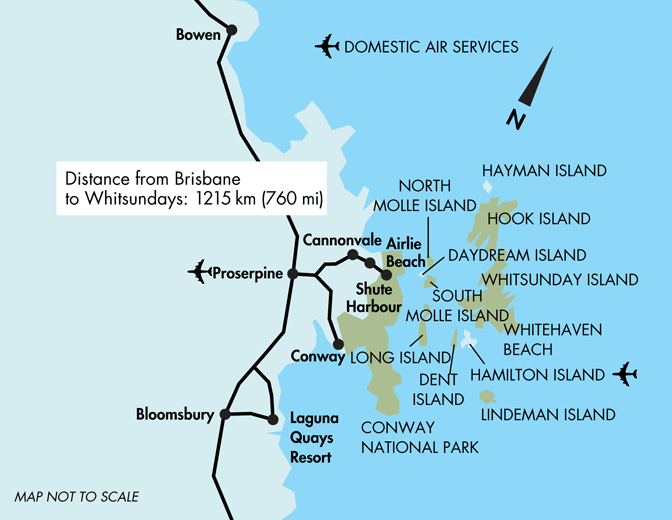
Map of the Whitsundays
The Whitsunday Islands comprises a collection of 74 islands of various sizes off the central coast of Queensland, Australia. The islands of The Whitsundays are divided into four groups: The Whitsundays Group, Lindeman Group, The Molle Group and the Northern Group.
Out of all the islands Hamilton Island is the largest inhabited island and also the commercial hub of the area.
As you can see on the map below we haven’t labelled all the islands just the main ones for tourism. You’ll also notice Airlie Beach and Shute Harbour which are the mainland jumping off points to explore The Whitsundays.
Whitsundays Map, 2002 Queensland Tourism
This Queensland Map is not to be reproduced outside Queensland Tourism guidelines. e-CBD is not able to give permission to reproduce this map
Other Maps